How Space-Based Data is Revolutionizing Agriculture
The convergence of space technology, artificial intelligence, and data-driven finance is reshaping global agriculture more profoundly than any development since the Green Revolution, and for the readers of DailyBusinesss.com, who follow the intersections of AI, finance, markets, sustainability, and trade, space-based data has moved from a niche scientific tool to a core strategic asset that informs decisions from family farms in Iowa and Punjab to institutional investors in London, Singapore, and Sydney. While satellites have been observing Earth for decades, the past five years have seen an unprecedented acceleration in the volume, resolution, and accessibility of orbital data, and this transformation, combined with advances in cloud computing and machine learning, is enabling a new generation of agricultural intelligence that is reshaping how food is grown, financed, traded, and insured worldwide.
From Weather Satellites to Precision Intelligence: A New Era in Agri-Space
The story of space-based agriculture began with coarse weather imagery and global land-use maps, but by 2026, constellations of small satellites operated by companies such as Planet Labs, ICEYE, and Spire Global, alongside public missions from agencies such as NASA, ESA, and JAXA, are delivering near-continuous, high-resolution imagery of the Earth's surface that can detect subtle changes in crop health, soil moisture, and water stress long before they are visible from the ground. Programs like NASA's Landsat and ESA's Copernicus Sentinel missions laid the foundation with open, scientifically rigorous datasets, but it is the layering of commercial constellations and advanced analytics that has turned space-based data into an operational tool for agribusiness, governments, and financial markets.
For the global audience of DailyBusinesss.com, the key shift is that satellite data is no longer just an input for agronomists; it is now a strategic resource for business leaders, investors, and policymakers who rely on real-time, location-specific intelligence to manage risk and allocate capital, and as readers explore broader business trends on DailyBusinesss Business, they increasingly see space-derived insights referenced in earnings calls, investment theses, and supply chain strategies across the food and beverage, retail, and commodity sectors.
The Technical Foundations: What Space-Based Data Actually Measures
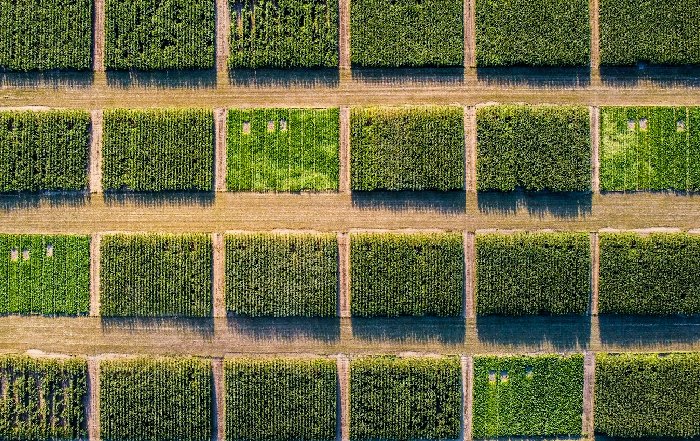
Space-based agricultural intelligence rests on a set of core measurements that, when combined and analyzed at scale, provide a richly detailed picture of the global food system, and understanding these fundamentals is crucial for executives and investors who wish to distinguish between genuine capability and marketing hype. Optical imagery, using visible and near-infrared wavelengths, forms the backbone of crop monitoring, allowing the calculation of indices such as NDVI (Normalized Difference Vegetation Index) and EVI (Enhanced Vegetation Index), which serve as proxies for plant vigor, chlorophyll content, and biomass; these indices, when tracked over time, allow analysts to detect early signs of nutrient deficiency, disease, or water stress at field level, enabling targeted intervention and more precise yield forecasting. Synthetic Aperture Radar (SAR), used by platforms such as Sentinel-1 and commercial providers, penetrates clouds and operates day and night, making it indispensable in regions with persistent cloud cover such as Southeast Asia, equatorial Africa, and parts of Brazil, while radar backscatter can reveal soil moisture, flooding, and structural changes in crops, offering critical data for both production management and disaster response.
Thermal infrared measurements, as provided by missions like ECOSTRESS and upcoming thermal constellations, measure land surface temperature and evapotranspiration, allowing more accurate estimation of crop water use and irrigation needs, which is particularly vital for water-stressed regions in the United States, Spain, Australia, and South Africa. When these satellite-derived variables are fused with ground-based sensors, weather station data, and historical yield records, and then processed using advanced AI and machine learning models, they generate predictive insights that can be operationalized by farmers, insurers, traders, and policymakers, a process that aligns closely with the broader themes covered on DailyBusinesss AI and DailyBusinesss Tech where the practical application of data and algorithms is a recurring focus.
Precision Agriculture: From Field-Level Insight to Operational Decisions
In 2026, precision agriculture has become one of the most visible manifestations of space-based data on the ground, particularly in technologically advanced markets such as the United States, Canada, Germany, Netherlands, and Australia, where large-scale farms and agribusinesses have the capital and connectivity to integrate satellite feeds into their daily operations. Satellite imagery, combined with drone surveys and on-machine sensors, enables variable-rate application of fertilizer, pesticides, and irrigation, reducing input costs while improving yields and mitigating environmental impact; platforms such as John Deere's Operations Center, Bayer's Climate FieldView, and several emerging European and Asian startups now routinely ingest satellite-derived vegetation and moisture indices to generate prescription maps that guide equipment in real time.
Research from organizations such as the Food and Agriculture Organization of the United Nations shows that precision agriculture can significantly improve resource efficiency, and readers can learn more about sustainable farming practices in that context, but the commercial story is equally compelling: in a world of tight margins and volatile commodity prices, the ability to apply inputs only where they are needed, and to forecast yields with greater accuracy months ahead of harvest, directly influences profitability, working capital requirements, and risk management strategies. For DailyBusinesss.com readers focused on operational excellence and technology-driven competitiveness, the integration of space data into farm management systems represents a powerful example of how digital transformation is reshaping a traditionally conservative sector.
Space Data and Financial Innovation: Insurance, Credit, and Investment
One of the most transformative impacts of space-based agricultural data is unfolding not in the field, but in the financial sector, where insurers, banks, and asset managers are using orbital intelligence to design new products, price risk more accurately, and expand access to capital, particularly in emerging markets across Africa, Asia, and South America. Index-based crop insurance, where payouts are triggered by objective indicators such as rainfall deficits, vegetation indices, or flood extent rather than on-the-ground loss assessments, has gained momentum as satellite data has become more reliable and granular; institutions such as the World Bank and the International Fund for Agricultural Development have supported pilots and programs that leverage satellite-derived indices to protect smallholders from climate shocks, and readers can explore global agricultural risk initiatives to appreciate the scale of this change.
For commercial banks and fintech lenders, space-based data provides a new form of collateral: by observing cropping patterns, yield histories, and land-use stability over time, lenders can assess creditworthiness in regions where formal land titles and financial records are weak or absent, which is particularly relevant in parts of India, Kenya, Nigeria, and Brazil where large segments of the rural population remain underbanked. Meanwhile, institutional investors and commodity traders are incorporating satellite-derived crop production forecasts into their models, using services from firms such as Gro Intelligence and Kayrros, alongside public resources like the USDA Foreign Agricultural Service, where analysts can review global crop production estimates that increasingly blend ground and space-based intelligence.
For readers of DailyBusinesss Finance and DailyBusinesss Investment, this convergence of space data and financial engineering is particularly significant, as it illustrates how information asymmetries are being reduced in agricultural markets, potentially reshaping pricing power, hedging strategies, and the allocation of capital across geographies and value chains.
Global Food Security, Geopolitics, and Market Transparency
Beyond farm and firm-level decisions, space-based data has become a critical tool in managing global food security and navigating the geopolitical dimensions of agriculture, especially as climate volatility, conflict, and trade disruptions have intensified in the first half of the 2020s. Organizations such as the World Food Programme and UN World Food Programme's Vulnerability Analysis and Mapping teams rely on satellite imagery to monitor droughts, floods, crop failures, and displacement in fragile regions across East Africa, the Sahel, and parts of the Middle East, allowing earlier intervention and more targeted humanitarian responses, and readers can learn more about satellite-based early warning systems that underpin many of these efforts.
At the same time, governments and international bodies are using space-derived data to enhance transparency in global grain markets, reducing the potential for misinformation and market manipulation, and agencies such as AMIS (Agricultural Market Information System), backed by the G20, increasingly incorporate satellite-based yield estimates into their assessments of global supply, which in turn inform policy decisions on export restrictions, strategic reserves, and trade negotiations. For the international business community that follows DailyBusinesss World and DailyBusinesss Markets, the growing role of space-based monitoring in global food governance adds a new dimension to geopolitical risk analysis, as satellite imagery can reveal not only crop conditions but also infrastructure damage, irrigation expansion, and land-use changes that signal strategic shifts by major producers such as China, Brazil, the United States, and Russia.
Climate Change, Sustainability, and ESG: Measuring What Matters
As climate risk and environmental, social, and governance (ESG) considerations have moved to the center of corporate and investment decision-making, space-based data has become indispensable for measuring, verifying, and reporting the environmental impacts of agriculture, which accounts for a significant share of global greenhouse gas emissions, water use, and biodiversity loss. Satellites enable the monitoring of deforestation, land degradation, and peatland conversion associated with agricultural expansion in regions such as the Amazon, Southeast Asia, and parts of Central Africa, and platforms like Global Forest Watch provide public dashboards where stakeholders can track deforestation and land-use change in near real time, a capability that has increased scrutiny on supply chains for commodities such as soy, palm oil, beef, and cocoa.
For companies and investors committed to credible ESG strategies, the ability to independently verify that suppliers are not encroaching on protected areas or violating zero-deforestation commitments is critical, and satellite data, often combined with geospatial analytics from firms like Satelligence and Descartes Labs, is now routinely referenced in sustainability reports and green bond frameworks. Additionally, space-based measurements of biomass, soil moisture, and land cover are increasingly used in carbon accounting and nature-based climate solutions, allowing verification of carbon sequestration projects in agroforestry, regenerative agriculture, and soil carbon initiatives, which are central themes for readers interested in sustainable business practices and the emerging low-carbon economy.
AI, Analytics, and the Fusion of Space and Ground Data
The raw volume of satellite data generated in 2026 is staggering, with petabytes of imagery and sensor readings collected annually, and the real value lies in the ability to transform this data into actionable insight through advanced analytics and artificial intelligence. Cloud platforms such as Google Earth Engine, Amazon Web Services, and Microsoft Azure provide the computational backbone for processing and analyzing global-scale datasets, while machine learning models trained on labeled field data can detect crop types, predict yields, and identify anomalies with growing accuracy; readers can explore how AI enhances Earth observation analytics to understand the technical underpinnings of these capabilities.
For agritech startups and established players alike, the competitive advantage increasingly resides not in owning satellites, but in developing proprietary algorithms, domain expertise, and integration capabilities that turn orbital data into decisions embedded in farm management software, risk models, and supply chain platforms. This aligns closely with the broader AI and technology narratives that DailyBusinesss.com covers on AI and Technology, where the emphasis is on how data and algorithms are reshaping industry structures, labor markets, and competitive dynamics across sectors.
Regional Perspectives: How Different Markets Are Adopting Space-Based Agriculture
The adoption of space-based agricultural solutions varies significantly across regions, reflecting differences in farm structure, connectivity, regulation, and capital availability, and these regional nuances are central to understanding the global opportunity set for investors, technology providers, and policymakers. In the United States and Canada, large-scale row crop farming and advanced machinery integration have driven early adoption of satellite-informed precision agriculture, with strong support from both private companies and public agencies such as the USDA and NASA, while in Europe, particularly in Germany, France, Netherlands, Spain, and the Nordic countries, regulatory frameworks like the EU Common Agricultural Policy and the Green Deal encourage the use of remote sensing to verify compliance with environmental standards and to optimize subsidy allocation, and readers can learn more about EU agricultural monitoring initiatives that increasingly rely on satellite data.
In Asia, the picture is more heterogeneous: China has invested heavily in its own Earth observation capabilities and is integrating satellite data into national food security planning and rural modernization strategies; Japan and South Korea focus on high-tech, smallholder-compatible solutions that blend satellite, drone, and robotics; while India, Thailand, and Malaysia are experimenting with public-private partnerships that use space data to support millions of smallholders through mobile-based advisories and index insurance schemes. In Africa and parts of South America, connectivity and affordability remain challenges, but donor-backed programs and impact investors are increasingly funding space-enabled services that support small farms, particularly in Kenya, Nigeria, Ethiopia, and Brazil, where the combination of satellite data, mobile phones, and digital payments is beginning to unlock new business models for advisory services, microinsurance, and input financing.
For the globally oriented readership of DailyBusinesss.com, these regional patterns underscore that space-based agriculture is not a monolithic market but a mosaic of localized opportunities and constraints, each requiring tailored go-to-market strategies, partnerships, and regulatory engagement, which in turn influence cross-border investment flows, trade dynamics, and technology transfer, key themes explored across DailyBusinesss Trade and DailyBusinesss Economics.
Founders, Startups, and the Emerging Agri-Space Ecosystem
The rapid evolution of space-based agriculture has given rise to a vibrant ecosystem of founders, startups, and scale-ups operating at the intersection of space, AI, and agriculture, and these entrepreneurs are playing a crucial role in translating raw satellite data into usable tools for farmers, agribusinesses, and financial institutions. Companies such as Planet Labs, SatSure, CropX, Orbital Insight, and a growing number of regional players in Europe, India, Brazil, and Africa are building specialized platforms that address specific pain points, from irrigation management and pest detection to credit scoring and supply chain traceability, often partnering with incumbents in agronomy, input supply, and banking to reach end users at scale.
For founders and investors who follow DailyBusinesss Founders, the agri-space sector illustrates several broader trends in technology entrepreneurship: the importance of domain expertise and local partnerships; the need to balance scalable SaaS models with on-the-ground support; and the growing role of climate and impact-focused capital that values both financial returns and measurable environmental and social outcomes. As space launch costs continue to decline and open data policies expand, barriers to entry on the data side are falling, but differentiation increasingly depends on integration, user experience, and the ability to demonstrate clear, quantifiable value to farmers and financial stakeholders under real-world conditions.
Employment, Skills, and the Future Agricultural Workforce
The integration of space-based data into agriculture is also reshaping employment and skills requirements across the sector, from farm managers and agronomists to data scientists and policy analysts, and this evolution has significant implications for labor markets in both developed and emerging economies. On the one hand, automation and data-driven decision-making may reduce the need for certain forms of manual monitoring and repetitive fieldwork, particularly in large-scale operations in the United States, Australia, and parts of Europe; on the other hand, new roles are emerging in geospatial analysis, remote sensing interpretation, digital agronomy, and technology integration, roles that require a blend of agricultural knowledge and data literacy.
Universities and training institutions in countries such as Germany, Netherlands, Singapore, and Canada are expanding programs in precision agriculture, geoinformatics, and climate-smart farming, while online platforms and corporate training initiatives aim to upskill existing agricultural professionals, and readers interested in labor market trends and the future of work can connect this shift to broader themes covered on DailyBusinesss Employment. For policymakers, the challenge is to ensure that the benefits of space-enabled agriculture do not exacerbate digital divides, but instead create inclusive pathways for rural youth, women, and smallholders to participate in higher value-added segments of the agricultural economy.
Challenges, Risks, and Governance of Space-Enabled Agriculture
Despite its transformative potential, the rise of space-based data in agriculture also raises important challenges and risks that business leaders, investors, and policymakers must navigate thoughtfully. Data privacy and sovereignty concerns are intensifying as high-resolution imagery makes it possible to monitor individual fields and farming practices, and questions arise about who owns and controls this data, how it can be used, and under what regulatory frameworks; countries such as France, Germany, India, and Brazil are debating how to balance innovation with the protection of farmers' rights and national security interests, and readers can explore global data governance discussions to understand how these debates intersect with broader digital policy.
There are also concerns about market concentration, as a small number of large technology and data providers could gain disproportionate influence over agricultural information flows, potentially shaping pricing, input recommendations, and risk assessments in ways that may not always align with the interests of farmers or food security objectives. Moreover, the reliability and interpretability of AI-driven analytics remain critical issues, particularly when they inform high-stakes decisions such as insurance payouts, credit approvals, or government interventions; ensuring transparency, validation, and accountability in these models is essential to maintaining trust among users and stakeholders. For readers who follow DailyBusinesss News, the governance of space-enabled agriculture is likely to become an increasingly prominent topic as regulators, industry groups, and civil society organizations seek to establish norms and standards that support innovation while safeguarding public interest.
Looking Ahead: Strategic Implications for Business and Policy
By 2026, it has become clear that space-based data is not a passing trend but a structural shift in how the global agricultural system is observed, managed, and financed, and for the business-focused audience of DailyBusinesss.com, the strategic implications are far-reaching. Companies across the food value chain-from seed and input providers to processors, retailers, and logistics firms-must decide whether to build, buy, or partner for space-enabled capabilities, integrating orbital intelligence into their planning, procurement, risk management, and sustainability strategies. Financial institutions, from commercial banks to asset managers and reinsurers, need to develop internal competencies in geospatial analytics or collaborate with specialized providers to ensure they are not disadvantaged in pricing risk and identifying opportunities in agriculture-linked assets, whether in public markets, private equity, or infrastructure.
Policymakers, meanwhile, face the dual task of leveraging space-based data to enhance food security, climate resilience, and rural development, while also establishing governance frameworks that address privacy, competition, and equity concerns; this will require cross-border coordination, public-private partnerships, and sustained investment in open data and digital infrastructure, particularly in lower-income countries. For global readers who track the interplay of economics, trade, technology, and sustainability across DailyBusinesss.com, the rise of space-based agriculture exemplifies how frontier technologies are moving from the realm of science fiction to become practical tools that influence everyday business decisions, investment strategies, and policy debates.
In the coming decade, as satellite constellations become even more capable, AI models more sophisticated, and climate pressures more acute, the ability to see, understand, and act upon what is happening in the world's fields from space will be a defining competitive and strategic advantage, and those organizations-whether in North America, Europe, Asia, Africa, or South America-that build the expertise, partnerships, and governance frameworks to harness this capability responsibly will shape not only the future of agriculture, but also the broader trajectory of global food systems, financial markets, and sustainable development.